
Kilcoy, Somerset Region


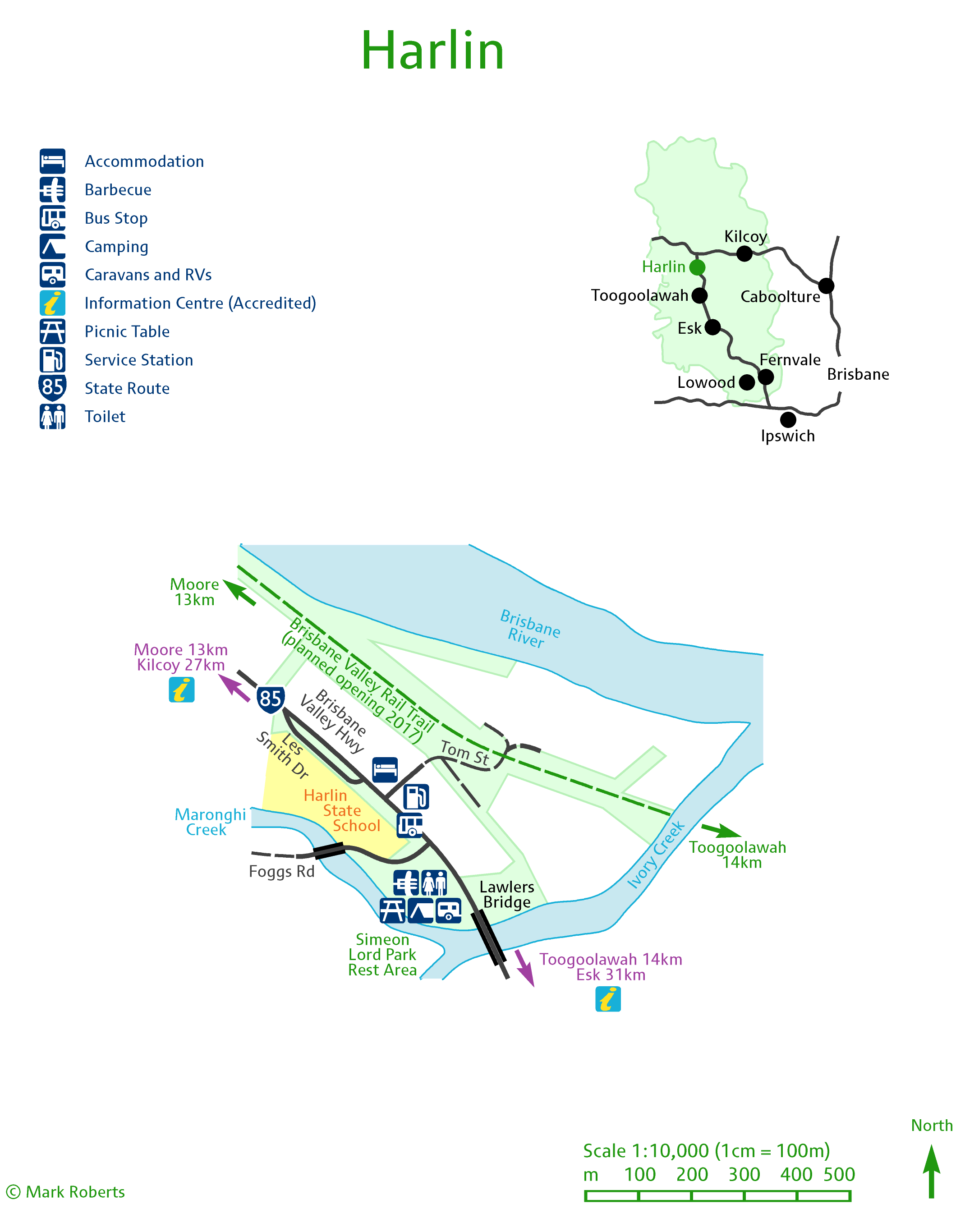
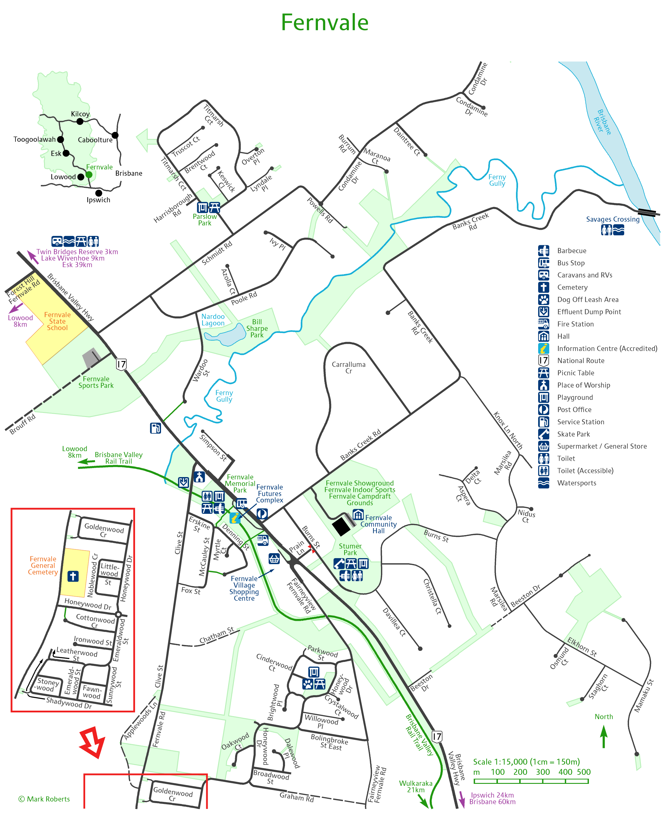

I have been contracted to create town maps for each of the communities in Somerset Region; here they are in draft form.

Ipswich City Council has recently signed these trails in the Eastern part of the Springfield development. These didn’t make it into the Family Bushwalks book.

Thanks to Mike for his help with this – the trail is being developed by the locals and the last stretch along the creek to the falls is unformed.

A recent development connecting Maleny in the Sunshine Coast almost as far as Gardners Falls – when the bridge is built.
