Thanks to Mike for his help with this – the trail is being developed by the locals and the last stretch along the creek to the falls is unformed.

Thanks to Mike for his help with this – the trail is being developed by the locals and the last stretch along the creek to the falls is unformed.
A recent development connecting Maleny in the Sunshine Coast almost as far as Gardners Falls – when the bridge is built.

A map I made as a sort of a joke about a lovely place in Brisbane – but it’s tiny and we didn’t put in our Family Bushwalks book.

Glen Rock State Forest has a little-used bushwalk and also a cycling / horse-riding trail along the creek to the Top Yards.


A little-known trail described in “Bush Walks in the Toowoomba Region” by McKilligan and Savage.

My new book created with Gillian Duncan is now available for purchase at www.familybushwalks.com.au. It’s our third book, following two books of recreational trails for cyclists; this one is aimed at walkers and runners who want to go bush without committing to long distances or lots of climbing.
300 walks are described in detail including of course a brand new fully researched topo map showing all points of entry, resources like water and shelter, and making clear the effort required to complete the walk.


Purple Pen is free software used to put orienteering courses onto orienteering maps. I’ve written up for Orienteering Queensland a guide for new users.
Here it is: www.markroberts.id.au/OQ/OQ_PurplePen.pdf
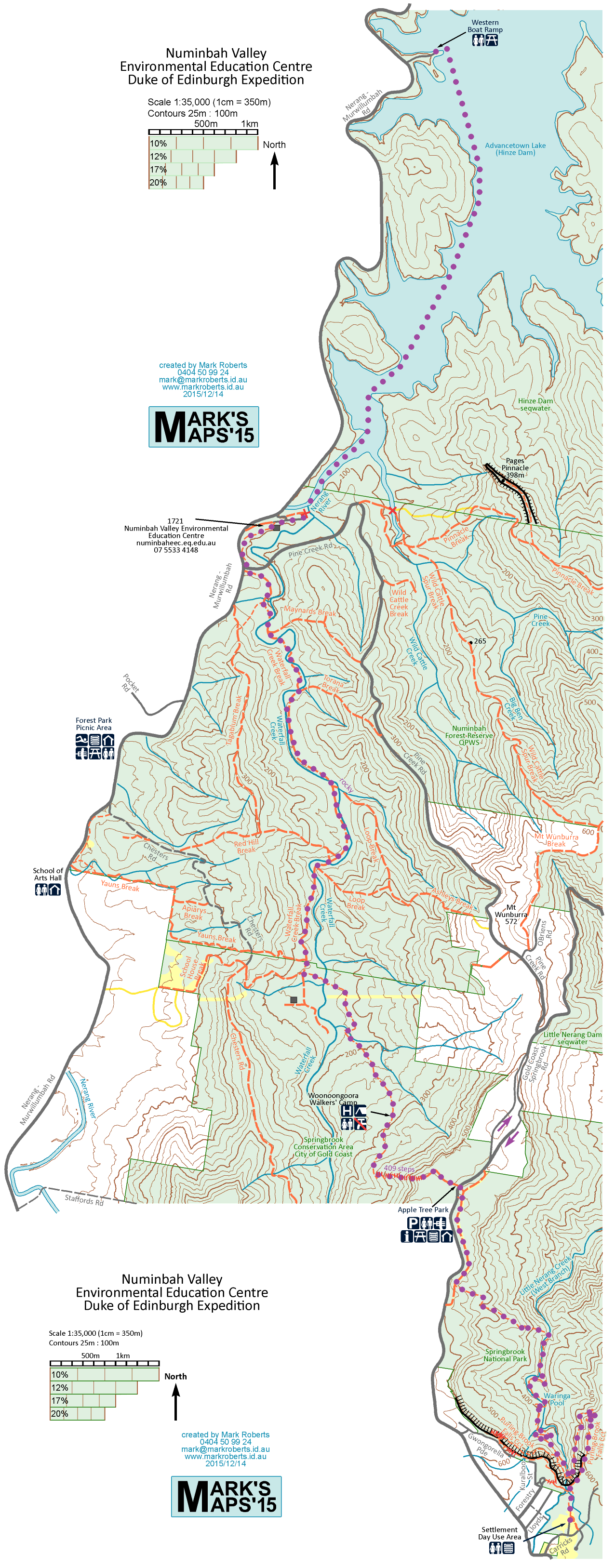
Here is a map I made for the Numinbah Valley Environmental Education Centre for the upcoming Duke of Edinburgh Expedition where youngsters walk 15km from Springbrook to NVEEC then kayak 5km to the Western Boatramp.
Varsity College is introducing orienteering into its curriculum so I offered to make a map of the oval across the road. It doesn’t have a school campus like most schools.
