This trail was rejected for our Family Bushwalks book because it is in poor condition.

Maps of more challenging bushwalks
This trail was rejected for our Family Bushwalks book because it is in poor condition.
A popular birdwatching and bushwalking destination in NE Brisbane; no cycling permitted. This map was designed for birdwatchers.

This one didn’t make it into our Family Bushwalks book because it’s rather too rugged:

More remote and difficult to reach bushwalks didn’t fit into our Family Bushwalks book, and here are the orphan maps I prepared for Amamoor State Forest: 


Here is a trail I investigated for our Family Bushwalks book but chose not to include.
It was a signed, sort of maintained trail which goes nowhere, rough in places, steep in places, primarily intended for and used by horse riders.
NEWS: It’s still steep and rough in places, but it has been extended NE by Council and lots of mountain bikers use it, so I’ve extended the map SW to Mt Wongawallan.

Numinbah Forest lies between the Numinbah and Little Nerang Valleys in the Gold Coast Hinterland; it is the venue of many organised walks each year. There is limited scope for mountain biking because it is generally steep and cycling is not permitted on many trails. Waterfall Creek is a relatively gentle ride.

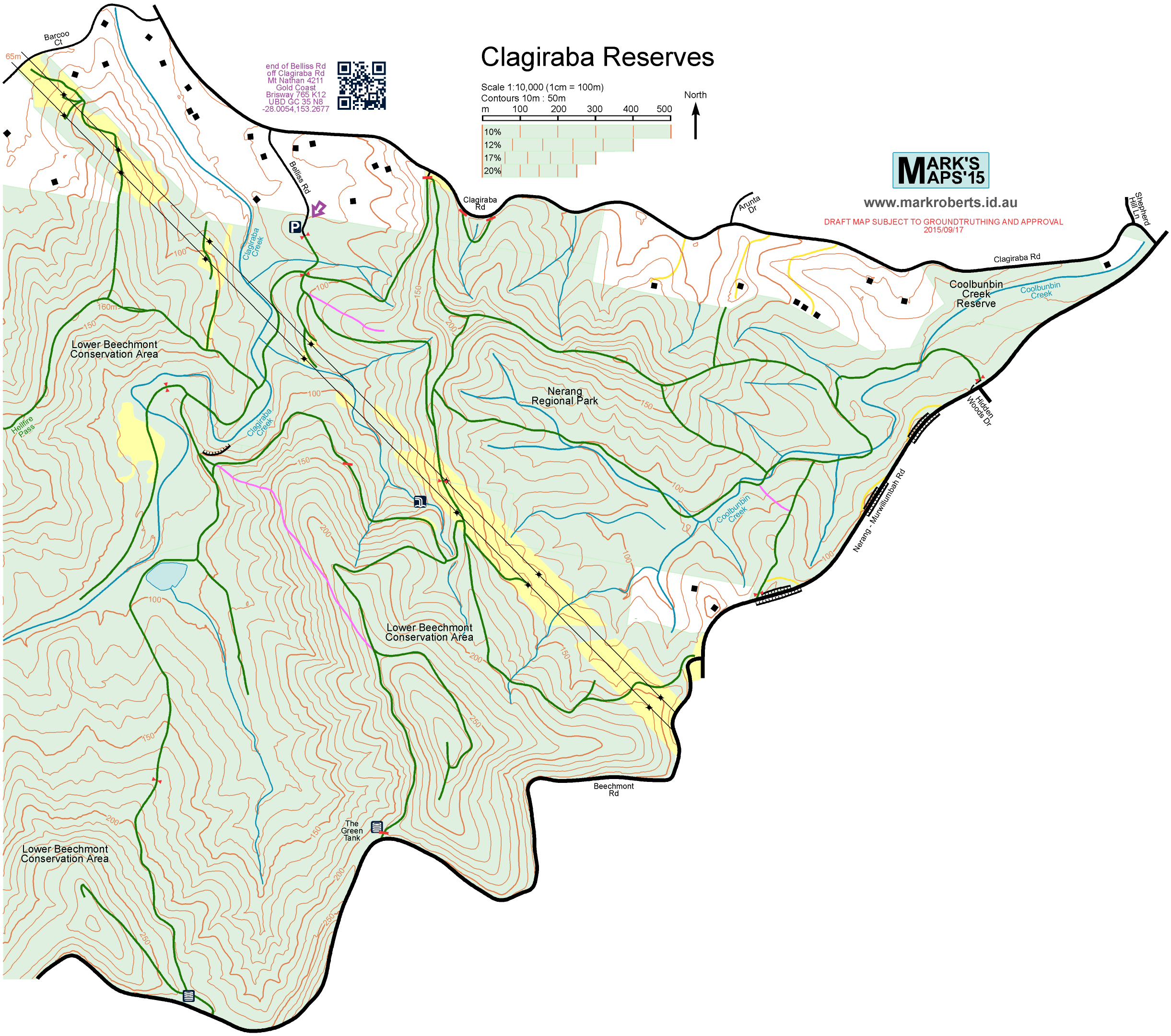
Here’s a map I at first created for Where to Mountain Bike in South East Queensland but the area is rather steep for riding. The walk along the creek from Belliss Rd is gentle and very pleasant.
Click through for the PDF:
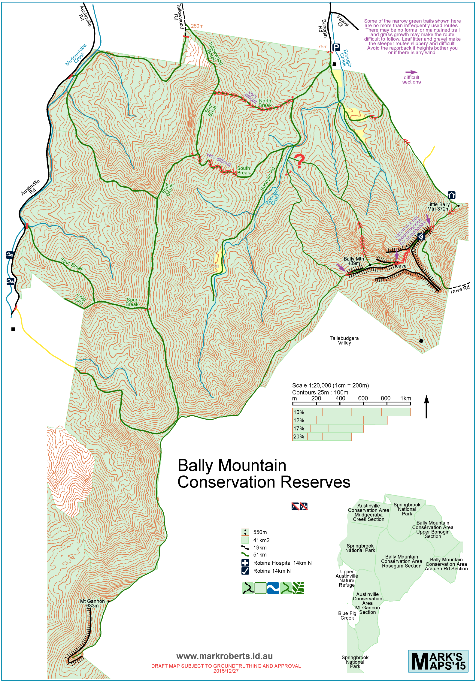
Bonogin Valley lies between the Tallebudgera and Mudgeeraba valleys half way down the Gold Coast. At the very end of Bonogin Road is the most accessible section of Springbrook National Park, part of the Bally (“Ball-ee”) Mountain Conservation Reserves. However this isn’t the Springbrook we know of rainforests and bubbling brooks, because it’s much lower in altitude.
Two entertaining geocaches near the summits of Little Bally and Bally Mountains and great views from the razorback make up for the horrible climb up Bally Mountain from the northeast – 200m ascent over a distance of 200m!
Click through for the PDF: