Thursday, 27 September 2007
Mid-Week Event, Centenary Parklands (Jindalee / Mount Ommaney), Brisbane
12:00 Thursday 27th September 2007
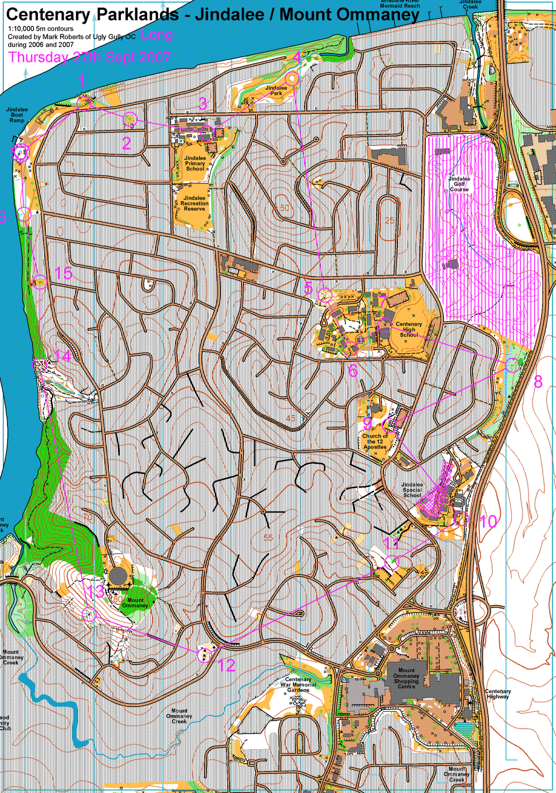
"Centenary Parklands" 2007 1:10,000 5m
UBD 177H18 12km SW of Brisbane CBD
"Long" 6.9km 220m climb (3.2%)
I drew the map, helped Sandy to design the course, put out half of the controls, and I also ran the long course. Remarkably, 6.9km as the crow flies translates to 9.6km round the streets, so my time of 74 minutes was respectable. I was half way down a field of 8, 18 minutes behind Mark N. The guns were all away interstate.
5: I avoided the hil by running all the way round to the east. A couple of competitors fought their way through the green to the east of 4 and went west of the hill.
9: Back the way I came
10: Left
13: Right and along the gap between the houses and the green. Others went via the top of the hill, or right then left and through the alley, finding themselves in a construction site.
14: Along the track
15: 3 competitors on the Medium course went through the green, I cannot imagine why they thought that was a good idea.
16: Some ran along the indistinct track, not I!
Best wishes to Robyn who hurt her hand.
Tuesday, 25 September 2007
Tuesday Training, Gap Creek
On request we repeated a control flow exercise, this time with another course on Gap Creek East with as many controls as I could fit in but without going too far from tracks or jumping about a great deal.
Sunday, 23 September 2007
Club event, Griffith University Campus, Nathan, Brisbane

09:00 Sunday 23rd September 2007
"Nathan Campus" 2007 1:5,000 5m
UBD 200M11 10km South of Brisbane CBD
"Long Red" 4.3km 155m climb (3.6%)
It's much greener than it looks, a superb map of an interesting area, My time was 56 minutes (13mpk) but Mark N was only 13 minutes ahead of me, woo hoo!
1 a direct compass struggle through the not very white found a control on the termite mound first; I wqorked out where I was quickly.
7 left round the road the through the lawns
8 straight to the road, left along the track and up the side of the spur
9 track to the EcoCentre, right of the line up the steps and across the bridge then through the lawns
10 right
12 approaching up through vague terrain with lots of broad gullies to choose from I didn't really know where I was; plan B was to overshoot tp the carpark and come back but I recognised the broad spur to the south and lost little time
13 went vague on me but I relocated at the waterhole.
Thursday, 20 September 2007
Mid-Week Event, Tyamolum Scout Camp, Mt Crosby

12:00 Thursday 20th September 2007
"Tyamolum Scout Camp" 2004 1:5,000 5m
UBD 175F16 19km WSW of Brisbane CBD
"Long" 14 controls 3.6km 140m climb (3.9%)
The course crisscrossed a small steep area so we had two copies of the map for two halves of the course. I did 36 minutes, 10mpk and came 9th out of 17, 13 minutes behind the winner.
Wednesday, 19 September 2007
OY, Buhot Creek, Priestdale, Brisbane

09:00 Sunday 16th September 2007
"Buhot Creek" 2001 1:15,000 5m
UBD 223M13 22km SE of Brisbane CBD
"Red 3" 12 controls 5.25km 175m climb (3.3%)
2:03 9:17 6:12 3:24 8:49 5:01 3:23 8:24 2:33 3:32 4:37 2:41 4:42
I had a very ordinary run, feeling sluggish on arrival and deciding to run Red 3 instead of maybe Red 2. My time of 64:38 (12.3mpk) gave me 7th place out of 23 but I was an enormous 17 minutes behind Rachel.
My only significant error was 5 minutes wasted on 2. Following the contour out of 1 I picked up the minor track to the track junction but we had been warned there were many extra tracks so I didn't really know where I was. I spent about a minute relocating; the understory is thick and it's tough to work out where you are. Setting off along the left bank of the marsh I expected to fall over the control but the 1:15,000 scale fooled me and the termite mound is a good 30m from the marsh so I overshot and came back from the track.
Thanks Elizabeth for the lift.
Thursday, 13 September 2007
Mid-Week Event, Pegg's Lookout, Salisbury, Brisbane
12:00 Thursday 13th September 2007
"Pegg's Lookout" 2007 1:7,500 5m
UBD 200D2 8km South of Brisbane CBD
"Long" 5.7km 265m climb (4.6%)
My only blunder was running from 17 to 7 and it's fairly obvious why that might happen on a course as complicated as this - this isn't actually my map BTW and my scrawl was more difficult to follow.
Clive created an awesome course as usual. I took 72 minutes and was 6th of 13 on the Long course in a field of 37 which sounds OK, but Dane did it in 50 minutes and Mike and SuYan beat me argh.
Nice map Geoff, nice event Clive.
Wednesday, 12 September 2007
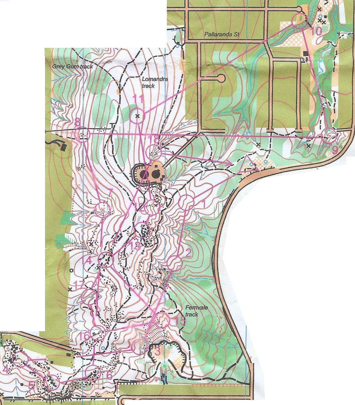
Tuesday Training, Gap Creek East, Mount Coot-tha
We were concentrating on contours, so following the usual warmup Clive asked us to estimate the height of the cliff at the stream bend (control 9 above) which was 5m high - few were accurate except the mappers amongst us (moi 8^). Then he asked us to start at the noticeboard and cross the oval until we had climbed 5m. Once again few were accurate, most climbing too far because the oval has a somewhat deceptive slope to the north. CP was using an inclinometer to judge this, with a 5m pole marked with 1m tags back at the picnic table.
We then used the pole and inclinometer to estimate 5m contour climbs up the northern track, first calibrating our eyehight against the measuring pole, then sighting ahead for a landmark at eyeheight. We varied in eyeheight from 1.5m (3.3 eyehights per 5m) to 1.8m (2.8 eyeheights per 5m.) Each of us became more accurate with practice. Doing the same downhill through bush was challenging because visibility made the landmark technique hard. By the end we were largely able to estimate one contour by feel rather than explicit technique.
Next CP asked us to walk a contour accurately through somewhat green bush. Actually walking the contour was difficult, so we practiced eyeballing a landmark at eyeheight then moving forward and adjusting our height to the same landmark. CP was confidently assessing our accuracy which had me puzzled until I realised he had tagged lots of trees with pink ribbons at his eyeheight using his inclinometer! He explained that pink was all he could find and would have preferred something less obvious.
Next was the opposite experience - running a course without contours, see above, without a compass. The map has only watercourses on it; you can interpolate the shape of the terrain very accurately if you are used to spur-gully. Leg 1 was tough (CP reckons the hardest on the course) and some of us got sucked west onto the parallel watercourse. Nevertheless it was remarkably easy to do, and got easier with practice until the last control - a track leads most of the way so we moved fast (I was in a bunch by then) and lost contact.
It was almost dark by then so we went home.
Thanks again Clive.
Sunday, 9 September 2007
State Event, Karingal, Mount Cotton

Sunday 9th September 2007
"Karingal" 2004 1:10,000 5m
UBD 224P9 24km SE of Brisbane CBD
"Red 2" 15 controls 6km 240m climb (4%)
Much confusion regarding the scale; advertised at 1:12,000 but actually 1:11,000. The setter did a quick course change at the last moment when they worked out that it was 1:15,000 not 1:10,000 - go figure. The map printing was also a disaster, very hard to read; offset printed maps had gone astray in the mail and they were sorted at the last moment.
Most route choices were straight:
5 Along the creek - messy and timewasting
6 Left along the hillside to avoid the cliffs and green
7 Straight - should have gone left on the track at the end to avoid the green
8 Slightly right to the track
9 A little left to conserve height, might have been better to climb out and run down the spur
14 Down the big gullyand along the track
I came 2nd in a field of 10, 3 minutes behind Bridget; the guns were on Red 1.
Thanks UG
Thursday, 6 September 2007
Mid-Week Event, Coombabah Wetlands, Gold Coast
12:00 Thursday 6th September 2007
"Coombabah Wetlands" 1:15,000 5m
UBD GC 18G10 60km SSE of Brisbane CBD
"Medium" 7 controls 4.8km no climb
A wet chilly day, the ground was waterlogged.
Adopting the usual take-care-on-1 I went round the track. The ditch gave me wet feet; attempting to follow the line of runnable forest alongside the marsh to 2, I thought I ran too far west into unmapped forest; a look at Google Earth says that really is marsh so I can't have. At any rate, a quick adjustment to running north allowed me to find the track at the dam and I was back on the map.
I went straight from 5 to 6 hoping to relocate on reaching the track but it proved difficult and cost me a minute or so.
My time of 47 minutes seems a bit ordinary at 10mpk but my route was about 6km long and I was 3rd of 5, 7 minutes behind the winner.
A double-check at the end proved that the magnetic north on the map is slightly out.
Thanks to Gary and Brett for the event.
Tuesday, 4 September 2007
Training session, Gap Creek
16:00 Tuesday 4th September 2007
Gap Creek East, Mt Coot-tha
3 youngsters and 5 not youngsters this week. First Clive asked us to do the usual jog round the oval, fast-slow-fast and funny running to and fro. Then Bridget led the crew on an interval session for 10 or 15 minutes while I put out streamers. I was using the full featured map but everyone else had contours only. Dane caught me at the ?9th control, I got home before Bridget and we waited a while for everyone one else; by then the light was shot (again) and we did the usual hill sprints, but forwent the exercises which would have required lying on the soggy ground.
Saturday, 1 September 2007
Club Event, Stockyard South, Burbank, Brisbane

14:00 Saturday 1st September 2007
"Stockyard South" 2004 1:10,000 5m
UBD 223H1 19km SE of Brisbane CBD
"Long" 4.7km 135m climb (2.9%)
I took about 47 minutes for 10mpk.
![]()
Subscribe to Posts [Atom]